This weekend has been exceedingly busy for us. But we have been left with an incredible sense of accomplishment and success. The weekend started for us around 5:00PM Friday when we left for the mountain house in Silverthorne. Besides the normal congestion on C470 between our home and Sante Fe Blvd, traffic really wasn't that bad. I guess a lot of people had heard the weather forecast for the weekend for the mountains and decided to stay home.
We made it to Silverthorne around 6:30PM and settled in for an early night. Given the time I hoped to rise on Saturday morning there was no way we were going to stay up late! Saturday morning dawned early for us (around 5:30AM) as I wanted us to get on the trail at a reasonable hour. After taking some time to clean up the condo and get ourselves ready for the adventure ahead, we were out the door. We stopped for a quick meal at the Dillon McDonalds and were on our way. (Yeah - I know eating at McDonald's isn't the best, but with the amount of calories that we normally burn off on a hike like this, I don't think it really matters.)
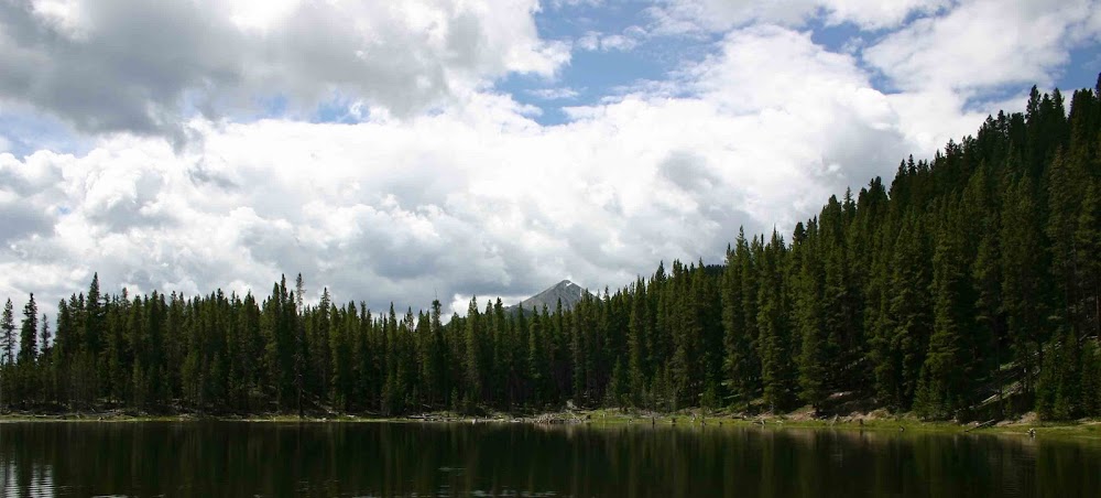
To reach the trail head for our hike we took I-70 to Frisco and then Colorado Rt 9 to Breckenridge. From Breckenridge we continued south on Rt 9 over Hoosier Pass and into the small town of Alma. Once in Alma we took the Kite Lake road into the wilderness. The Kite Lake Road is a dirt road that penetrates 6 miles into the heart of the Mosquite Range. It ends at the aptly named Kite Lake. The drive wasn't bad as it is a drivable dirt road as opposed to a 4x4 track.
Along the way to Kite Lake we had an encounter with an irresponsible jerk. Most people driving along dirt roads understand the etiquette of how to drive on a dirt road. We were part of a line of 4 cars moving along the road. We were all going 20 mph or so because the road was rough. When travelling on a washboard dirt road, you can't go too fast or you will just bounce right off. You could tell all of us were probably experienced at driving along dirt roads in the mountains based upon the way we were driving. Out of no where from behind us comes along an idiot in a bright and shiny Lexus 4x4. He decided that he had to get to Kite Lake faster than anyone else and had to pass this line of 4 cars. He was driving at an excessive speed and was doing things that would endanger himself and others. It really annoyed the heck out of me to see this person behaving so recklessly. I didn't do anything rash, but you could see people in the other cars giving the driver of the Lexus the middle finger. I don't know why - but the whole thing just pissed me off.
After that little incident the rest of our drive to the trailhead was uneventful. There is a parking lot at the trailhead and it was reasonable parked up, but we were able to find a parking space only 100 yards from the trail head.
It took me about 10 minutes to get all of our gear gathered up, organized and stuffed into my backpack. I had decided to take some extra things with me and so my pack weighed on the order of 20 - 30 pounds - which is the heaviest backpack I have hiked with in a while. (When I go on back packing trips I will normally shoulder a 60 - 80 pound back pack.)
Once we were ready we started and quickly came to the trailhead. At the start of the trail there was a gentleman from the Colorado 14er's Initiative telling everyone about the land use issues associated with Mount Cameron and Mount Bross. His basic recommendation for everyone was to stay clear of those peaks. For a complete description of the land use issues, you can check out this link to the Colorado 14'ers initiative. http://www.14ers.org/peaks_Mosquito_Bross.php
Being good citizens we decided that we would do our best to stay off of these peaks so I changed our hiking plan to just reach Mount Lincoln. To reach Mt. Lincoln you first walk along the northern shore of Kite Lake before heading straight up a very significant ridge. Shortly after we started our hike both Zack and I were gasping for air as we were climbing at a significant rate. This first part of the hike is through grassy terrain that is pretty forgiving on your feet and knees.
In a short distance the environment begins to take on a much more unforgiving tone. The grassy slopes give away to continuous scree and talus fields that are murder on your feet and knees. At various points along this steep up hill climb the trail almost becomes totally lost in this giant talus field. The only saving grace are the extensive number of tall stone cairns that mark the trail.
This steep up hill climb continues for about 1 mile until you reach a "saddle" with a beautiful view between the ridges that run up to Mt. Democrat and those that run up to Mt. Lincoln and Mt. Cameron. To reach the top of Mt. Democrat you go to the south on this ridge while to reach Mt. Lincoln and Cameron you head to the north.
Once you have begun heading north the climb becomes a little bit more reasonable for a while until you enter a series of switchbacks through the continuous talus fields. These switchbacks continue to wind up the side of Mt. Cameron. I had expected that at some point we would have the option to take a trail that didn't carry us over the summit of Mt. Cameron but I was wrong. The only way to reach Mt. Lincoln was to go over the summit of Mt. Cameron.
At long last we reach the summit of Mt. Cameron. The summit itself is just a flat space at the top of a significant ridge. From the "summit" of Cameron you can see the distinct profile of Mt. Lincoln. As I stood there on the top of Cameron I realized that we had a somewhat scary climb ahead of us to make the summit of Mt. Lincoln. Up to this point, Zack had been heads down working hard to make the summit of these mountains. I wondered how he would feel about climbing to the top of Mt. Lincoln.
From the summit of Mount Cameron, there is a down hill section (I believe you lose about 190 feet) that you must cross to reach the summit block of Mt. Lincoln. The terrain between Mount Cameron and Mount Lincoln is very desolate. It is one continuous talus/scree field. Little to nothing grows on it and it makes you feel like you are in the middle of the worst desert in the world. I have read a lot about the environment in Mongolia and other high places and the environment here definitely made me think of what I have read.
From this desolate area between Cameron and Lincoln, you can see the path you must follow to reach the summit of Lincoln. At the base of the summit block it does not look like a lot of fun to reach the summit.
Regardless of what it looked like both Zack and I were determined to at least try and make it to the top of Lincoln. We did manage to negotiate the "path" to the top of Mt. Lincoln and we were able to sit at the summit and soak in the success of our efforts. Our time on the summit of Mt. Lincoln was limited as rain clouds were beginning to move into the area. After about 15 minutes on the summit we decided it was time to head down.
While we were at the summit Zack got a lot of praise from some experienced hikers and climbers. By far he was the youngest person we saw on the trail. (We saw a couple of teenagers but no kids as young as Zack.) Most of the experienced climbers were amazed that a kid of that age was able to make to the top of such a difficult mountain.
Given the extent of the building rain clouds we opted to take the shortest route down the mountains and back to the car which required us to retrace our steps up Mt. Cameron and then back down into the saddle between Lincoln/Cameron and Democrat. We moved as quickly as we could because neither of us wanted to be caught in a lightning storm at that attitude.
The trip down in some ways was as hard as the trip up. Going down through this severe and inhospitable environment of rock and talus took a huge toll our my thighs, knees and ankles. But we were determined to get down as quickly as we could. The total elapsed time for us to get down was on the order of 1.75 hours - which worked out perfectly as we were able to just beat the storm. Rain drops began falling around the same time we were getting in the car and getting ready to get out of there.
The hike was great success and I am so proud of Zack for doing what he did. As I said in my blog title yesterday - we did amazing things on Saturday.
I don't have time to post pictures today as I am on the verge of falling asleep as I type. I will definitely get pictures of this posted tomorrow. Also I will describe Zack being in the color guard presenting the flag during the national anthem at the beginning of Sunday's Rockies game.
Well - I am off to bed as I am having a hard time staying awake.
Thanks and peace to all! - J.
3 comments:
Hmmmm, Mt. Democrat.... Where is Mt. Republican? Or Mt. Conservative?? :-)
Umm... What can I say to that one? There is much fodder for jokes in this one Robin (at least I think it was Robin who left this comment). I have actually searched my Colorado topo maps for a Mount Republican but with no success. I guess our forefathers who named these mountains definitely had some good sense! ;-). I AM JUST TEASING!!!!
Yes, it's Robin. Sorry 'bout that. I usually sign my posts "Robin in Texas" but in my haste forgot to this time. Thanks for the info, Jerry - at least you TRIED to find a Mt. Republican! :-D
Robin in Texas
Post a Comment