I like to call myself the “stupidest man in the world”. By calling myself the stupidest man in the world it allows me to easily exceed anyone’s expectations of me – kind of nifty huh?
Every once in a while I truly do something that makes me the “stupidest man in the world”. What I have done this time is that I have entered a bicycle touring event called “Death Ride 2009”. Just by entering a ride called that I truly do think I have demonstrated a high level of stupidity. Any ride with a name like that cannot be easy.
All joking aside, this ride is going to be a very serious ride and will be the centerpiece of my athletic accomplishments for the 2009. The ride is 129 mile bicycle ride in ONE DAY. It covers 5 mountain passes and has an overall elevation gain of 15,000 feet. Needless to say it is going to be hard. The ride takes place in California and starts in Markleeville. I’ll be doing the ride with an old friend of mine who I found on Facebook – Max Holtom. I have until July 11th to train for this brutal ride.
For anyone interested the details of this ride can be found at the Death Ride website -
http://www.deathride.com/
Though it is only the end of January I realize that I am going to have to start to train for this ride soon. I will really need to concentrate on my hill riding. During my last big bicycle tour – Bicycle Tour Colorado 2008, I found that I had an exceeding hard time with some of the hill climbs. I had done a huge amount of riding in preparation for that tour, but I hadn’t spent enough time concentrating on hills. I will not make that mistake again.
I plan to do a lot of training in Summit County, Colorado where our “mountain house” is located. Summit County is the winter and summer playground of Colorado and has an average elevation of 9000+ feet. There are many good bike paths throughout the county that will allow me to do some serious hill climbing. The Vail Pass bike path is one example of these bike paths. This path follows I-70 from Frisco the whole way over Vail Pass and into the Vail Valley. From Frisco to Vail this is about a 25 mile one way trip with some significant elevation gain (about 3000 feet) as you climb over Vail Pass.
Unfortunately Zack is not up to this level of bicycling so I am going to have to work hard to develop a schedule by which I can do my riding and have some one watching him. I do hope in the coming years he will be interested and able to do rides like this with me. But for now this kind of riding is above him. He is a great hiker now I just have to see if he has the desire to do this kind of biking.

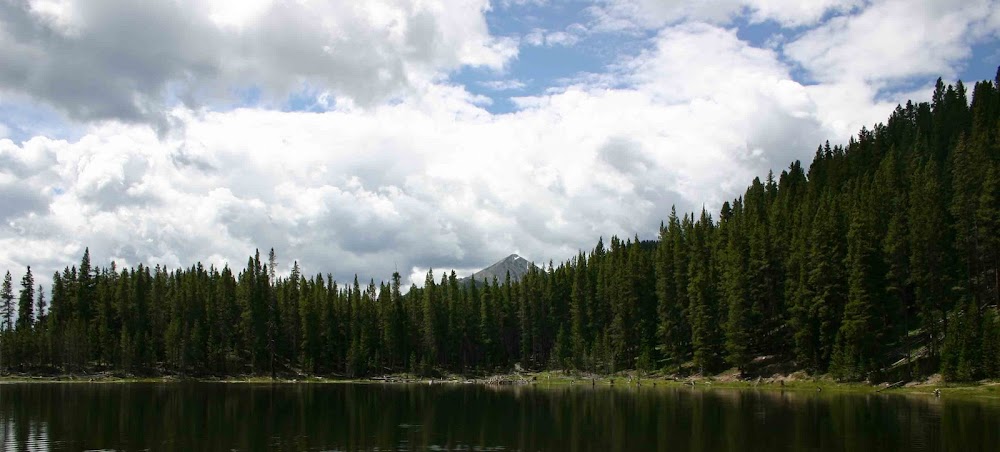
(The above picture is of me during Bicycle Tour Colorado 2008)
Though I have classified this as one of the stupidest things I have done, I will readily admit that I am really looking forward to it. I am estimating that it will take me 8 – 10 hours of hard riding to complete this tour. I know at the end of it I will have blisters on my butt and I will be exhausted. Regardless of how hard it is and how tired I will be, the feeling of accomplishment I will have when I reach that finish line will be immense! So it may be stupid and it may hurt, but all I can say is – bring it on!!!
Peace to all!
 You have to love Facebook. Since I have an iPhone I can provide up to the second updates on what Zack and I are doing via the Facebook application for the iPhone. In my opinion it is so very cool!
On Sunday we returned to our hiking ways and went out and did 3 miles on the Highline Canal. For some silly reason we decided to take Lex with us. Of course Lex loved the idea. But for Zack and I it made things a little harder.
The temperature on Sunday was only 17 degrees – so we were cold as can be, even though we were all bundled up. Holding Lex’s leash doesn’t allow you to have gloves or mittens on your handles so both Zack and I had ice cubes for hands.
Zack wanted to hold Lex’s leash for the majority of the walk. I figured “Why not?” Unfortunately for Zack, Lex decided more times than not that he wanted to take off. Well – as much as Zack held on he wasn’t going to keep Lex back. So Zack faced two choices, let go of Lex or hold on for the ride. Most of the time he just let go and Lex was off like a lightning bolt. On several occasions Zack decided to try and hold on. This meant that Zack was dragged along the ground as Lex ran full speed ahead. After a couple of times of this Zack decided it was just time to let go and catch up with Lex later. The hike was good but we certainly were happy to get back into car and get warm!
You have to love Facebook. Since I have an iPhone I can provide up to the second updates on what Zack and I are doing via the Facebook application for the iPhone. In my opinion it is so very cool!
On Sunday we returned to our hiking ways and went out and did 3 miles on the Highline Canal. For some silly reason we decided to take Lex with us. Of course Lex loved the idea. But for Zack and I it made things a little harder.
The temperature on Sunday was only 17 degrees – so we were cold as can be, even though we were all bundled up. Holding Lex’s leash doesn’t allow you to have gloves or mittens on your handles so both Zack and I had ice cubes for hands.
Zack wanted to hold Lex’s leash for the majority of the walk. I figured “Why not?” Unfortunately for Zack, Lex decided more times than not that he wanted to take off. Well – as much as Zack held on he wasn’t going to keep Lex back. So Zack faced two choices, let go of Lex or hold on for the ride. Most of the time he just let go and Lex was off like a lightning bolt. On several occasions Zack decided to try and hold on. This meant that Zack was dragged along the ground as Lex ran full speed ahead. After a couple of times of this Zack decided it was just time to let go and catch up with Lex later. The hike was good but we certainly were happy to get back into car and get warm!
 Monday’s adventure was pretty low-key – Sylvan Learning Center for tutoring on writing/composition. I decided several months ago that Zack really need some help with his writing. Though he has a great vocabulary and great ideas, he really has a hard time translating the thoughts in his head onto the paper. So he is schedule to received 3 – 5 months of tutoring at Sylvan to help him write better. Though it will be a fairly large expense, it will definitely be worth it if he can improve his writing.
We did not have any major adventures today except for dinner at one of Zack’s favorite restaurant – Gunther Toody’s. It isn’t anything special – it is a 50’s style hamburger joint that makes great shakes and hamburgers. Zack got his favorite shake – a Butterfinger’s shake. He loves Butterfingers. He was only able to finish half of it, so I got the rest.
I did have one unique thing happen this evening. After I had completed my work for the day, I decided to take a run/walk along the Highline Canal near Arapahoe and University. There is a large park there along the canal. In the gather gloom of the setting sun, I spied a lone coyote just sitting in the middle of a field in the park. It was really quite neat as he saw me and didn’t do a thing. He didn’t run – he just sat there. Though coyotes have a bad reputation around here, he was amazing cute. I stood there for several minutes just watching him before I got too cold and had to move on. It is great to encounter wildlife anywhere!
Til later – thanks and peace to all!
Monday’s adventure was pretty low-key – Sylvan Learning Center for tutoring on writing/composition. I decided several months ago that Zack really need some help with his writing. Though he has a great vocabulary and great ideas, he really has a hard time translating the thoughts in his head onto the paper. So he is schedule to received 3 – 5 months of tutoring at Sylvan to help him write better. Though it will be a fairly large expense, it will definitely be worth it if he can improve his writing.
We did not have any major adventures today except for dinner at one of Zack’s favorite restaurant – Gunther Toody’s. It isn’t anything special – it is a 50’s style hamburger joint that makes great shakes and hamburgers. Zack got his favorite shake – a Butterfinger’s shake. He loves Butterfingers. He was only able to finish half of it, so I got the rest.
I did have one unique thing happen this evening. After I had completed my work for the day, I decided to take a run/walk along the Highline Canal near Arapahoe and University. There is a large park there along the canal. In the gather gloom of the setting sun, I spied a lone coyote just sitting in the middle of a field in the park. It was really quite neat as he saw me and didn’t do a thing. He didn’t run – he just sat there. Though coyotes have a bad reputation around here, he was amazing cute. I stood there for several minutes just watching him before I got too cold and had to move on. It is great to encounter wildlife anywhere!
Til later – thanks and peace to all!


 I always think it is so amazingly beautiful when you get out in the middle of a great tract of prairie. Literally there is nothing there – just rolling hills and acre after acre of brown dried grass. I am sure some people would have a hard time finding beauty in this stark environment. But there is plenty of beauty all around – and nothing as beautiful as the sound of silence.
 Our hike was about 5 miles and we went over many rolling hills. As we mounted one hill top we would see another hill for us yet to climb. As we walked further and further we could see the prairie coming to an end as the scrub brush and small trees that mark the start of the mountains began.
We had the whole place to ourselves. We only saw two other people during the two hours that we were out there. Each of our fellow hikers were alone and moving fast. For the most part we just said a courteous hello and let them pass us by. We did ask the second hiker – a woman to take a picture of the two of us together. But otherwise we left them pass us by without a lot of conversation and resume their journey in silence.
Our hike was about 5 miles and we went over many rolling hills. As we mounted one hill top we would see another hill for us yet to climb. As we walked further and further we could see the prairie coming to an end as the scrub brush and small trees that mark the start of the mountains began.
We had the whole place to ourselves. We only saw two other people during the two hours that we were out there. Each of our fellow hikers were alone and moving fast. For the most part we just said a courteous hello and let them pass us by. We did ask the second hiker – a woman to take a picture of the two of us together. But otherwise we left them pass us by without a lot of conversation and resume their journey in silence.  The weather was such that there were frequent snow showers that came upon us suddenly. This only added to the sound of silence that filled our ears. The snow seemed to eat any manmade sounds that penetrated the prairie. As the snow fell around us you could almost hear the sounds of the snowflakes impacting on the dry grass and dirt.
With snow in the air the landscape took on a magical quality as an opaque hazy hung over the mountains. Our eyes were tricked with views that would appear and disappear as each snow squall came and went.
We enjoyed every moment of our hike today. We did find our silence – our sound of wilderness in the beauty of Sharptail Ridge open space. We look forward to going back and experiencing this place of great natural beauty in every season of the year.
Peace!
The weather was such that there were frequent snow showers that came upon us suddenly. This only added to the sound of silence that filled our ears. The snow seemed to eat any manmade sounds that penetrated the prairie. As the snow fell around us you could almost hear the sounds of the snowflakes impacting on the dry grass and dirt.
With snow in the air the landscape took on a magical quality as an opaque hazy hung over the mountains. Our eyes were tricked with views that would appear and disappear as each snow squall came and went.
We enjoyed every moment of our hike today. We did find our silence – our sound of wilderness in the beauty of Sharptail Ridge open space. We look forward to going back and experiencing this place of great natural beauty in every season of the year.
Peace! We currently have 5 GPS units. The first is a Garmin GPS II Plus. I received this as a Christmas gift 11 years ago. It was my first and only GPS unit for over 7 years. It saw a lot of duty as I hiked and biked my way across parts of Colorado.
About 4 years ago I got my second GPS a Foretrex 101. This unit came with a strap and could be worn around my wrist. When I got this unit, my GPS use began to increase dramatically. It was so easy to just strap it to my wrist and go. I didn’t have to hold it in my hand – it was basically like wearing a big wrist watch. This is now the unit that Zack uses whenever we go hiking.
Over the last 2 years I have acquired 3 more GPS devices. Two of these devices, the Edge 305 and Edge 705, are specifically made for bicycling and serve as GPS enabled bike computers. They are slick and work very well.
The last dedicated GPS unit that I purchased was the Forerunner 305 and it is now my most heavily used GPS. It is pretty much always with me in case I decide to go out for a spur of the moment hike or a long distance walk. It provides me with real time data on how many calories I am burning, my heart rate (if I am wearing the heart monitor), distance, elapsed time and many other items.
Our newest GPS is the iPhone that I got as a belated Christmas present for myself. It has many GPS features in it, but I doubt that I will really use many of them. The iPhone is really cool in terms of what it can do. One of my favorite features is that you can add an application to Facebook that allows you to track where you are in the world via the GPS that is in your iPhone. That is pretty darn cool if you ask me!
Everyone who is reading this probably now thinks I am the ultimate geek – and I probably am. However, the GPS units have added a lot of adventure to the activities that Zack and I do outdoors. We definitely feel like we will never get lost if we have our trust GPS’s in hand!
If anyone would like any information about GPS devices for hiking, camping or bicycling drop me a line. I tend to know just a little bit about them.
Thanks for reading my ramblings of the day.
Peace!
We currently have 5 GPS units. The first is a Garmin GPS II Plus. I received this as a Christmas gift 11 years ago. It was my first and only GPS unit for over 7 years. It saw a lot of duty as I hiked and biked my way across parts of Colorado.
About 4 years ago I got my second GPS a Foretrex 101. This unit came with a strap and could be worn around my wrist. When I got this unit, my GPS use began to increase dramatically. It was so easy to just strap it to my wrist and go. I didn’t have to hold it in my hand – it was basically like wearing a big wrist watch. This is now the unit that Zack uses whenever we go hiking.
Over the last 2 years I have acquired 3 more GPS devices. Two of these devices, the Edge 305 and Edge 705, are specifically made for bicycling and serve as GPS enabled bike computers. They are slick and work very well.
The last dedicated GPS unit that I purchased was the Forerunner 305 and it is now my most heavily used GPS. It is pretty much always with me in case I decide to go out for a spur of the moment hike or a long distance walk. It provides me with real time data on how many calories I am burning, my heart rate (if I am wearing the heart monitor), distance, elapsed time and many other items.
Our newest GPS is the iPhone that I got as a belated Christmas present for myself. It has many GPS features in it, but I doubt that I will really use many of them. The iPhone is really cool in terms of what it can do. One of my favorite features is that you can add an application to Facebook that allows you to track where you are in the world via the GPS that is in your iPhone. That is pretty darn cool if you ask me!
Everyone who is reading this probably now thinks I am the ultimate geek – and I probably am. However, the GPS units have added a lot of adventure to the activities that Zack and I do outdoors. We definitely feel like we will never get lost if we have our trust GPS’s in hand!
If anyone would like any information about GPS devices for hiking, camping or bicycling drop me a line. I tend to know just a little bit about them.
Thanks for reading my ramblings of the day.
Peace!


 Tomorrow is back to school and work for most of us. I hope it goes well for everyone!