Life is what you make of it. Be happy, love a lot and have ADVENTURES!
Saturday, January 3, 2009
1 January 2009 - The Hiking Duo Conquer Spruce Mountain
Our New Year started in a wonderful way. We didn’t do anything on New Year’s Eve so we woke relatively early. It was a beautiful day here in the Front Range of Colorado and we were determined to get out and enjoy a wonderful hike through nature.
Our chosen place to hike on this wonderful New Year’s Day was a place called Spruce Mountain. Spruce Mountain is located about 30 miles to the south of our home in Southern Douglas County. It is one of the remaining areas between Denver and Colorado Springs that has not been developed. Thankfully it will never be developed as much of this area has been set aside as open space. This area is very close to the Greenland Open Space in which Zack and I hiked on December 28th.
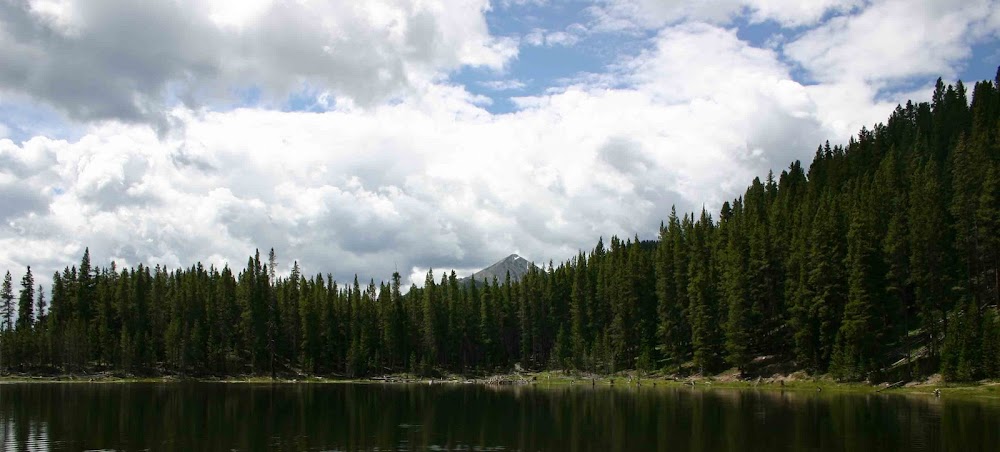
Spruce Mountain is a mesa that rises up from the plains around it. It offers a dramatic backdrop to the broad open plains all around. There are several other buttes and mesas located around Spruce Mountain, but it offers the most scenic vistas.
Our hike started at the base of the mesa and then wound up the northwestern side until we reached the top. The climb to the top wasn’t that bad as there were many switchbacks and the elevation gain really wasn’t that much. However due to the fact that we were climbing the northwestern side, much of the trail was covered in ice. The northwestern side of the mesa gets very little sun at this time of year due to the location of the sun in the sky. We walked carefully but still we ended up slipping and sliding during much of the climb.
When we finally reach the top of the mesa, we were greeted with an outstanding view to the east. The side of the mesa is ringed with steep cliffs that drop 40 – 50 feet straight down. We stood on the top of these cliffs and looked down at the plains below. It was a marvelous way to open the New Year.
The Mesa Top trail leads the whole way around mesa. At every twist and turn of the trail there are dramatic views. We savored the views and had some wonderful conversation as we walked. Zack decided that we needed to call ourselves the “Hiking Duo”. He told me so many marvelous things that were on his mind. I just positively love this time I spend with him – it is so wonderful and enjoyable.
Along the way we met a couple from Monument, Colorado and we spent some time talking with them. The had some recommendations for future hikes and they strongly suggested that we stop in the little town of Palmer Lake and have some ice cream at the Rock House Ice Cream shop. You can imagine the effect that had on Zack. He was very into the idea of having some ice cream!
After we left this couple we continued rambling on the Mesa Top Trail until we reached the southern most point of the mesa – Windy Point. The rock formations at Windy Point were quite dramatic so we sat down and ate our little snack there and took a bunch of pictures of each other.
We then headed around the other side of the loop that makes up the Mesa Top trail. The return trip was uneventful and we enjoyed all the views as we walked along the cliff top that made up the east side of the mesa.
On our way down the side of the mesa we did encounter a problem and it made me really re-think my preparedness for our hikes. As we were descending the switchbacks down the side of the mesa, I twisted my ankle. I managed to catch myself pretty quickly and didn’t really do much damage to my ankle. However, if I had not been able to correct the situation quickly there is a pretty good chance I would have broken my ankle. This really got me to thinking about my preparedness to handle any situation we might face in the wilderness.
I travel with just about everything that you need to face an emergency in the wilderness. We have warm clothes, food, water and other survival gear with us. However, I really need to invest in a Colorado “Search and Rescue” license and an emergency locator beacon. The “Search and Rescue” license is kind of like an hunting or fishing license. If you are hurt in the back county and need to be rescued (i.e. carted off the mountain in a stretcher) the “Search and Rescue” license pays for the cost of the rescue. The emergency locator beacon is similar to the beacons on airplanes and ships. If you run into problems you activate the beacon and a signal is sent to a satellite which relays the distress call to a 911 call center. Search crews are then sent out to the point that the distress call originated from. These beacons are expensive – on the order of 400 or 500 dollars, but if something happens to me, I want Zack to be able to be rescued. So that cost will definitely be worth it to give us peace of mind.
We didn’t encounter any other issues and my ankle is just a little bit sore. Once we got back to the car we head further south to Palmer Lake and enjoy a nice little lunch and ice cream at the Rock House.
Both Zack and I hope that everyone has entered the New Year with a positive viewpoint on life and is enjoying life. Be happy!
Peace!
Subscribe to:
Post Comments (Atom)
1 comment:
nice entery
Post a Comment