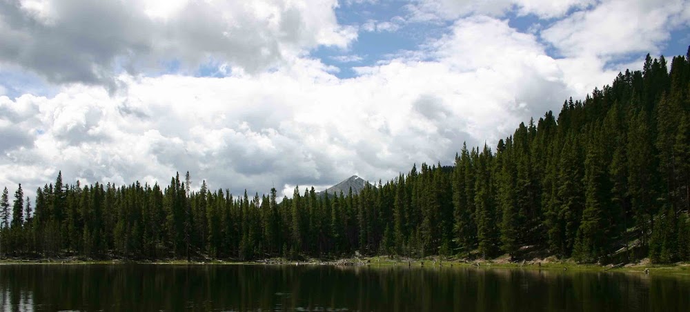
Numerous times in the past I have mentioned what I consider to be one of Denver's hidden natural gems - The High Line Canal Trail. This trail runs from the mountains to the plains and it winds its way through many of Denver's suburbs.
In the past, I have hiked, walked or run on about 1/2 of the distance of this trail. My wandering has been mainly confined to that section of the trail that is to the west of Interstate 25. For the last six or so months however, I have frequently driven past sections of the trail that are to the east of Interstate 25. One of Zack's best friends lives a short distance off the trail on Quebec Street. In the course of the many times Zack and I have driven to his friend's house we have had the occasion to drive across half a dozen or so street crossings of the trail. Each time I have driven across the trail, I have thought how cool it would be to start and hike the entire trail from one end to another.
I am not proposing to do that hike all once as it is over approximately 66 miles in distance. Though I consider myself to be a good hiker, I can't do 66+ miles in one day. However I can break it up into manageable distances and knock out 10 - 20 miles of the trail per week.
With the beautiful weather we had in Denver today, I decided to start hiking the trail again. This time my goal is to hike the entire trail from one end to another within the calendar year. It really shouldn't be that hard of a goal and to be honest it really is not. The only thing that makes it somewhat difficult is that I have to normally cover twice the distance. My normal manner of hiking the trail is to take the car, drive to a trail head or a nearby park and then walk out 2 -3 miles. Then I have to turn around and get back to the car. Therefore, I have to cover double the distance. Other than that, hiking the 66+ mile trail isn't that big of a deal.
As you can probably tell by the name of the trail, The Denver High Line Canal Trail, it follows the course of an irrigation canal. The purpose of the canal is to provide the "plentiful" water of the mountains to the agricultural areas of what is now the Denver Metro area. The canal was originally conceived a few short years after Denver got it's start as a city. The idea was first floated in 1870, but construction on the canal didn't begin until 1880. From start until finish, construction took 3 years, which to me, seems like a very short period of time for work that was done exclusively through manual labor - as there were no mechanical means to build the canal in those days.
From it's completion, the canal has provided a not so steady stream of water to the arid farm lands on the plains. In it's earlier days, I am quite sure it ran on a much more consistent basis, however in the most recent years the flow of the water in the canal has been restricted quite often due to the extreme droughts that Colorado has faced. In fact there are very few, if any agricultural customers who still utilize the High Line Canal. Denver Water now owns and maintains the canal and so the use of the canal is all incorporated into the overall Denver Water management plan. Additionally the canal, given it is simply an earthen ditch is a very inefficient means of delivering water as it is estimated that between 60 - 80% of the water is lost to evaporation or just drains out of the canal into the nearby ground.
The trail along the canal didn't open for recreational purposes until the 1970's as prior to that it was considered private property. Even now, sections of the trail are sometimes closed by Denver Water for various reasons. However, access to the trail is one of the governing principles that Denver Water uses in it's overall management plan.
Besides walking, hiking and running the trail is also used for biking and horseback riding. Pretty much any non-motorized type of recreation is allowed along the trail. Though due to the rough nature of the trail as it is primarily dirt and gravel - I won't recommend riding a high performance road bicycle on it nor would I recommend skate boarding or inline skating!
To keep track of my progress on the trail I am going to take pictures of each of the mile markers as I pass them. It might get a little confusing for me at times as there are 4 or 5 different entities that work with Denver Water to maintain the trail. And through each of their sections they use different mileage equations. But as I pass each marker I am going to take a picture of it!
If you have any interest in learning more about the trail, here's a link to the Denver Water Website on the trail. Additionally, you can check out the entire length of the trail on Google Earth. Just go to Google Earth and type in Denver High Line Canal Trail in the Fly To Box and it will take you to the center point of the trail.
For those of you who read this and live in Denver, if you have interest in hiking this thing with me, please let me know. As I always say for my hikes and bike rides - the more the merrier!
And here are the pictures of the first two mile markers I passed today! Mile markers 42 and 43 are now officially complete!

(The hanging sunglasses are someone's attempt to get a lost article back to whom ever lost it. I wonder if it ever works or if the lost item - sunglasses, hats, gloves, etc - just hang out for a really long time!)

Well that's about it for today. Nothing else of significance to note! I hope everyone had a wonderful Tuesday!
Thanks and peace to all! ~J.
No comments:
Post a Comment