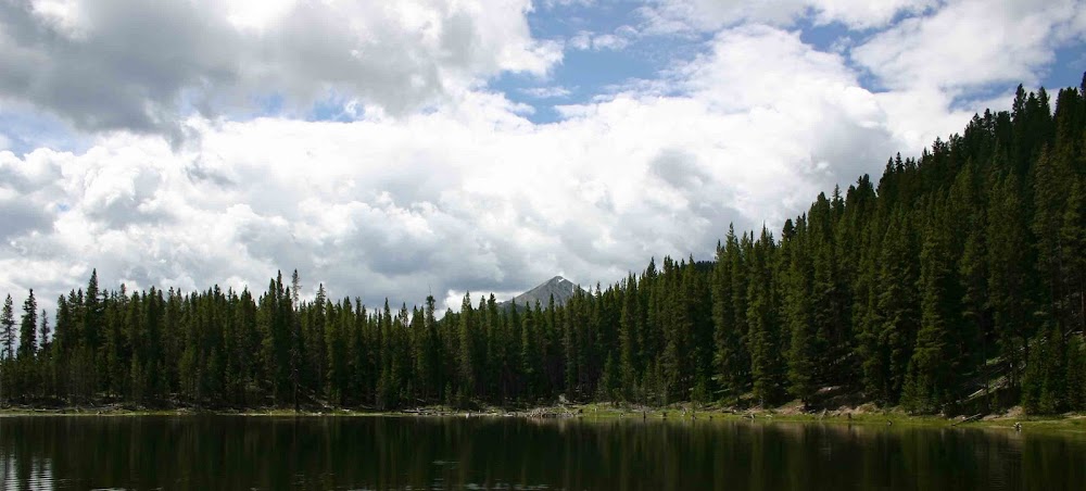
The old saying "April Showers bring May flowers", certainly is not coming true this spring in Colorado. Rather than April showers we experienced a steady stream of April blizzards and snowstorms. Keeping this theme going from April to May, the first day of this new month brought another snow storm that has dumped at least half a foot of snow.
Though the moisture is desperately needed to rectify the drought conditions that have plagued Colorado for the last 2 - 3 years, it has turned hiking trails into morasses of mud, dirty snowy slush and plain old muck. Trail conditions have dampened my enthusiasm to get out and hike in the mountains. Slogging through mile after mile of slippery, goopy mud is a miserable way to enjoy the Colorado's beautiful outdoors. In addition to the unpleasantness of the situation, the conditions frequently lead to sprain or hurt ankles and knees as it is very easy to slip, slide or fall.
Since mid-April, Zack and I have only gotten out for two hikes in the wilderness. Instead we have chosen to spend much of our weekend hiking time churning out miles on the relatively good surface of Denver's Highline Canal Trail.
The two hikes we have done in the wilderness have been memorable as they resulted in reaching the summit of mountains which we have never before climbed. The first of these two hikes was to the top of Evergreen Mountain in Jefferson County's Alderfer/Three Sisters Open Space Park. The weather for this hike was wonderful! After a week of cold weather and snow, Saturday April 13th dawned clear and warmer. Setting out on the trail around 10:00AM we experienced temperatures in the sixties and a slight breeze blowing from the southwest. Despite the great weather the trail was a mess, with swamp like conditions in many places. Where the trail wasn't a swamp we found deep piles of snow remained from the snowstorms of the previous days.
Though the parking lot was filled with many cars, the trails leading to the Evergreen Mountain were lonely and desolate. The relatively poor conditions of the trails explained the dearth of people in that part of the park. Instead of heading to the heights, most of the visitors to the park that day stayed in the meadows at the lower elevations. In total we only saw four other people on our hike to the summit of Evergreen Mountain.
The trail was nondescript, winding through a forest of mature lodgepole pines. One section of the forest has been systematically thinned to provide a test environment for forest management. There were many fewer trees in the area that had been thinned, but they did look a bit more robust than the forest that was overgrown.
The top of the mountain is relatively flat with one large mound of boulders and rocks that rise about 30 feet above the surrounding terrain. It is not a magnificent summit by any sort of the imagination, but it was still wonderful for us to get out and complete this hike! The views to the west were worthwhile as Mount Evans, one of Colorado's fourteeners dominated the horizon in it's snow capped beauty.
Coming down from the summit was quick and easy. The only issued we faced was the slipperiness of the wet, muddy trail. There were several times in which both Zack and I nearly ended up face down in the mud. The worst we received however was some wet and muddy shoes.
The other mountain that I "climbed" I did on my own during my lunch hour 2 Friday's ago. The weather was crappy but after a long week of difficult conference calls and heads down work, I decided I needed to get out and do something. Green Mountain on the west outskirts of Lakewood, a suburb of Denver, was calling my name.
Green Mountain isn't a mountain that stands out because of it's height and majestic visage. It's shear size and bulk is the reason that most people notice it. The mountain is really one of the first major foothills directly to the west of downtown Denver. Two of Denver's major highways, I-70 and C470, intersect in it's shadow. Though so close to civilization, Green Mountain does retain a sense of wildness and isolation.
There are numerous points from which you can attack this mountain. I choose the most direct route - a steep ascent from the western side. The parking lot for this trailhead is located on the western side of C470. To reach the trail, you must cross the highway on a pedestrian bridge that also is part of the C470 bike path.
Once I crossed the bridge, I realized that I was in for a little bit more of a difficult hike than I had anticipated. The major cause of this difficulty was the amount of slushy snow that covered the trail. Green Mountain is close to 700 feet higher than our home in Centennial. Though it is only 700 feet, it does make a tremendous amount of different when it comes to whether snow will melt or not during many of spring snow storms. Snow had fallen for much of the previous day and while it had all melted off at our house, the trails on Green Mountain were a mess!
The trail leading from the western side of the mountain does not pussy foot around. Instead of taking a slow meandering approach through back and forth switchbacks, the trail leads in almost a straight line up to the summit of the mountain. It's a quick hike but it does leave you huffing and puffing for air!
With the crappy weather on hand, I did manage to have the entire mountain to myself. That is the benefit of going out and enduring the nasty weather, you can actually find some solitude. I reach the top in about 45 minutes and took the obligatory panoramic picture with my iPhone, checked myself in at the summit on Facebook and was headed back down. There was no reason to linger at the summit and I wanted to be home before Zack arrived there from school. Regardless of the crappy weather and the fast speed that I hiked this mountain, it was still a very good thing for me to do. Literally I have driven by this mountain hundreds of times and I have never climbed it. Now I can say I have!!

Besides these two jaunts into the mountains, if you can call them that, Zack and I have been going out each Saturday and covering a lot of miles on the Highline Canal Trail here in the city. I have written extensively about the trail before, so I won't give another overview. We are definitely on track to hike the entire 66 mile length of the trail this calendar year. We are tackling some of the least spectacular parts of the trail first. Most of the distance we have covered so far this year has been at the eastern end of the trail in Aurora. I am certain that this section of the canal probably hasn't seen water in it for at least 4 or 5 years. Therefore, the canal has a somewhat run down appearance to it. This matches the neighborhoods that line the trail/canal as they are certainly not the best. Last Saturday when we parked, I couldn't find a park or school by which to leave the car - which is my preferred approach. Instead I ended up parking near a very rundown apartment complex. I wasn't sure if we were going to come back to find the car stolen or broken into. Thankfully that didn't happen, but these sections of Aurora through which we have hiked/walked over the last 2 weeks have certainly been sketchy. Regardless we still love getting out and exploring the trail!


Another work week has come to an end and we will be getting up to some adventures for the weekend. Saturday morning will see us up early and headed to Washington Park as tomorrow is the Denver Dumb Friend's League (DDFL) annual Furry Scurry. It's a 2 mile walk in Washington Park that is used to raise money to support the DDFL's mission of providing care and shelter to lost and abandoned pets.
Well - it's getting late and I am getting tired - so off to bed for me. I hope everyone has a great weekend ahead.
Thanks and peace to all! ~J.
Though the moisture is desperately needed to rectify the drought conditions that have plagued Colorado for the last 2 - 3 years, it has turned hiking trails into morasses of mud, dirty snowy slush and plain old muck. Trail conditions have dampened my enthusiasm to get out and hike in the mountains. Slogging through mile after mile of slippery, goopy mud is a miserable way to enjoy the Colorado's beautiful outdoors. In addition to the unpleasantness of the situation, the conditions frequently lead to sprain or hurt ankles and knees as it is very easy to slip, slide or fall.
Since mid-April, Zack and I have only gotten out for two hikes in the wilderness. Instead we have chosen to spend much of our weekend hiking time churning out miles on the relatively good surface of Denver's Highline Canal Trail.
The two hikes we have done in the wilderness have been memorable as they resulted in reaching the summit of mountains which we have never before climbed. The first of these two hikes was to the top of Evergreen Mountain in Jefferson County's Alderfer/Three Sisters Open Space Park. The weather for this hike was wonderful! After a week of cold weather and snow, Saturday April 13th dawned clear and warmer. Setting out on the trail around 10:00AM we experienced temperatures in the sixties and a slight breeze blowing from the southwest. Despite the great weather the trail was a mess, with swamp like conditions in many places. Where the trail wasn't a swamp we found deep piles of snow remained from the snowstorms of the previous days.
Though the parking lot was filled with many cars, the trails leading to the Evergreen Mountain were lonely and desolate. The relatively poor conditions of the trails explained the dearth of people in that part of the park. Instead of heading to the heights, most of the visitors to the park that day stayed in the meadows at the lower elevations. In total we only saw four other people on our hike to the summit of Evergreen Mountain.
The trail was nondescript, winding through a forest of mature lodgepole pines. One section of the forest has been systematically thinned to provide a test environment for forest management. There were many fewer trees in the area that had been thinned, but they did look a bit more robust than the forest that was overgrown.
The top of the mountain is relatively flat with one large mound of boulders and rocks that rise about 30 feet above the surrounding terrain. It is not a magnificent summit by any sort of the imagination, but it was still wonderful for us to get out and complete this hike! The views to the west were worthwhile as Mount Evans, one of Colorado's fourteeners dominated the horizon in it's snow capped beauty.
Coming down from the summit was quick and easy. The only issued we faced was the slipperiness of the wet, muddy trail. There were several times in which both Zack and I nearly ended up face down in the mud. The worst we received however was some wet and muddy shoes.
The other mountain that I "climbed" I did on my own during my lunch hour 2 Friday's ago. The weather was crappy but after a long week of difficult conference calls and heads down work, I decided I needed to get out and do something. Green Mountain on the west outskirts of Lakewood, a suburb of Denver, was calling my name.
Green Mountain isn't a mountain that stands out because of it's height and majestic visage. It's shear size and bulk is the reason that most people notice it. The mountain is really one of the first major foothills directly to the west of downtown Denver. Two of Denver's major highways, I-70 and C470, intersect in it's shadow. Though so close to civilization, Green Mountain does retain a sense of wildness and isolation.
There are numerous points from which you can attack this mountain. I choose the most direct route - a steep ascent from the western side. The parking lot for this trailhead is located on the western side of C470. To reach the trail, you must cross the highway on a pedestrian bridge that also is part of the C470 bike path.
Once I crossed the bridge, I realized that I was in for a little bit more of a difficult hike than I had anticipated. The major cause of this difficulty was the amount of slushy snow that covered the trail. Green Mountain is close to 700 feet higher than our home in Centennial. Though it is only 700 feet, it does make a tremendous amount of different when it comes to whether snow will melt or not during many of spring snow storms. Snow had fallen for much of the previous day and while it had all melted off at our house, the trails on Green Mountain were a mess!
The trail leading from the western side of the mountain does not pussy foot around. Instead of taking a slow meandering approach through back and forth switchbacks, the trail leads in almost a straight line up to the summit of the mountain. It's a quick hike but it does leave you huffing and puffing for air!
With the crappy weather on hand, I did manage to have the entire mountain to myself. That is the benefit of going out and enduring the nasty weather, you can actually find some solitude. I reach the top in about 45 minutes and took the obligatory panoramic picture with my iPhone, checked myself in at the summit on Facebook and was headed back down. There was no reason to linger at the summit and I wanted to be home before Zack arrived there from school. Regardless of the crappy weather and the fast speed that I hiked this mountain, it was still a very good thing for me to do. Literally I have driven by this mountain hundreds of times and I have never climbed it. Now I can say I have!!

(The panoramic picture I took from the top of Green Mountain.)
Besides these two jaunts into the mountains, if you can call them that, Zack and I have been going out each Saturday and covering a lot of miles on the Highline Canal Trail here in the city. I have written extensively about the trail before, so I won't give another overview. We are definitely on track to hike the entire 66 mile length of the trail this calendar year. We are tackling some of the least spectacular parts of the trail first. Most of the distance we have covered so far this year has been at the eastern end of the trail in Aurora. I am certain that this section of the canal probably hasn't seen water in it for at least 4 or 5 years. Therefore, the canal has a somewhat run down appearance to it. This matches the neighborhoods that line the trail/canal as they are certainly not the best. Last Saturday when we parked, I couldn't find a park or school by which to leave the car - which is my preferred approach. Instead I ended up parking near a very rundown apartment complex. I wasn't sure if we were going to come back to find the car stolen or broken into. Thankfully that didn't happen, but these sections of Aurora through which we have hiked/walked over the last 2 weeks have certainly been sketchy. Regardless we still love getting out and exploring the trail!


(A few of the mile markers we have walked past on the Highline Canal Trail. My goal is to take a picture of each of the mile markers along the entire length of the trail.)
Another work week has come to an end and we will be getting up to some adventures for the weekend. Saturday morning will see us up early and headed to Washington Park as tomorrow is the Denver Dumb Friend's League (DDFL) annual Furry Scurry. It's a 2 mile walk in Washington Park that is used to raise money to support the DDFL's mission of providing care and shelter to lost and abandoned pets.
Well - it's getting late and I am getting tired - so off to bed for me. I hope everyone has a great weekend ahead.
Thanks and peace to all! ~J.


